How we can Increase and Preserve the Island’s water supply through
Forest Management
The concern for water supply in
Jamestown has increases each year and rises to near panic stage when the
summer months have less than normal precipitation and rumors of wells
running dry increase. This study was done to address the question of
available water resources and provides a new solution for maintaining a
sustainable supply through forest management. It begins with an overview
of current resources and methods of use.
Where our water supply is...
There are two water supply resources for Jamestown on the northern land
mass that service approximately 90% percent of the residents. Most
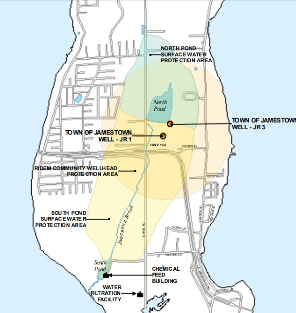
noticeable is North Pond that is the primary supply of the Town’s water
department. It delivers water to the Village and Beavertail (aka The Southern Islands). The other supply is hidden from
view because it lies a few yards below the surface known as the Bedrock
Aquifer.
North Pond gets it’s water through surface runoff from rain that lands on the elevated terrain around it’s perimeter. The Town Water system also has other resources that are not as noticeable which include South Pond, at the southern most portion of the Northern Land mass about 500 yards north west of the Town’s Water Treatment facility. It also gets it’s water from rain runoff from the farm property, as well as the Jamestown Brook that runs from the North Pond a bit over a mile along the western part of North Road. The land that services the Brook is also elevated terrain with significant run off from rain events.
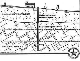
The Bedrock Aquifer is only available by drilling from the surface through the till layer (topsoil). It is the single resource for homes on the North Island and is also dependent on rain events. The needs of the Town’s Water district have required drilling of two high volume wells, into the same aquifer, that are used during the summer when demand increases beyond a safe level for the ponds.
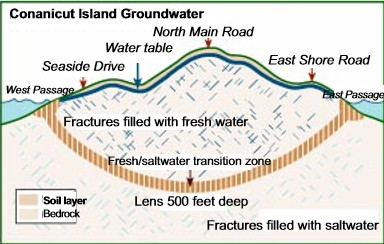
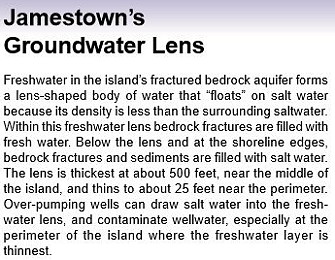
Research by the Rhode Island department of Water Management indicates that the Bedrock Aquifer is 500 feet deep at the center of the land mass which follows North Road, and it moves gradually toward the East and West shorelines at a curved angle where the fresh water supply is eventually restrained by the salt water intrusion from the bay.
The water supply capacity of a bedrock aquifer is based on the size and amount of cracks in the rock that are called fractures. There is a detailed analysis in our 2018 Water Supply Report but simply said... the more fractures the better, and the larger the opening between the fractures the better. Of the three bedrocks that make up Jamestown, the southern most is Beavertail, it is considered only slightly fractured, the Village bedrock is modestly fractured, and the North Island has proven to be Highly fractured.
Drilling a well to access water from a bedrock aquifer has it’s risks because the hole that remains needs to penetrate enough of the water holding fractures to generate the required supply to service a household’s needs, which is generally 5 gallons per minute of use from a 100 foot deep well.
The typical drilled hole has a diameter of 8 inches. It is finished off by a pipe at least long enough (usually 20 feet) to go below the upper soil and several feet into the top of the bedrock. Supply does not begin until the bottom of the pipe, which could receive upper pressure if water filled cracks are higher and connect to the fractures below the pipe.
A home developer seeking well water from a modestly fractured bedrock might have to drill several holes to find one that can meet the requirements of building codes. In a highly fractured bedrock there are still risks but usually finding the right spot on the first try is more likely.
When we consider that an 8 inch hole has a surface area of 50 inches and a typical quarter acre lot has 1,728 potential hole locations, getting the right placement on the first try is quite a feat. It is even more impressive when considering that the placement of the well in a neighborhood, especially one that has individual waste water treatment systems in use, can be cut down to a small area of chance due to required set backs to protect water quality.
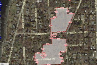
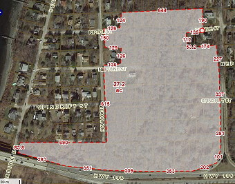
Another challenge of the bedrock well on the North End is to drill deep enough to have sufficient water supply for those times when the rain season is drier than usual. This is especially important in the Jamestown Shores neighborhood where there is a high concentration of homes built on small lots. Since the terrain is elevated, 130 feet above sea level at the highest point, and slopes east and west toward the shoreline, a well should be drilled deep enough to penetrate the sea level depth of the Aquifer lens but not too deep to penetrate the bedrock below the lens which gets higher as the location is closer to the shoreline.
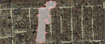
In a North End water quality study done in 1997, about 100 wells were tested and the data from the results listed well depth and surprisingly, when located on a contour map, shows several between 50 to 99 feet deep that are at elevations putting them at risk during dry conditions.
How much water is needed from the Aquifer and other data!
In a
2018 Water Supply Study
it was established that due to the
ISDS recharge returned to the bedrock from household use and the likely
volume of water in the bedrock area, odds are that the Jamestown Shores
area is not at risk of shortages in supply.
The Town’s Water Department that services the village has been implementing improvements to increase supply with recent construction of a runoff capture system along North Road feeding into the marsh around the pond. Although there are a few challenges to the treatment plant’s volume capacity, their users also are not at high risk of running dry.
The Jamestown Water Department’s recent update to their Water Supply System Management Plan (revised in 2018) shows the average daily use of their customers at 155,000 gallons per day that is supported by their reservoirs with a 60,000,000 gallon capacity for North Pond and 8,000,000 for South Pond. They show a daily safe yield of 283,000 gallons per day which is nearly twice the average daily usage.
That supply is also backed up by two deep aquifer wells that each have the capacity of 50,000 gallons per day that are used alternately during high demand summer months. Understanding that the Jamestown Water Department also services public buildings and commercial business needs in those totals, the report projects an average increase in use of just 13,000 more gallons per day by the year 2036, which is still well below the safe yield with today’s resources and before runoff supply is determined from the new North Road Recharge project.
Forest Management and Supply Benefits
Based on the Town’s 2015 Comprehensive Plan’s
buildout analysis, the total population, if all available lots were
occupied, should be a bit over 7,000 residents, whenever that
occurs. Looking at the population growth data from the RI Dept. of
Administration, Division of Planning, the future needs for water should
not increase much from today with their projections for 2040 being
5,674, which is only a few hundred more than our 2010 census total of
5,405.
But looking at the full buildout impacts for water needs, the North Island, with no town water and ISDS for sewerage, the estimated 402 additional homes would increase the bedrock aquifer demands by just 16,000 gallons per day. The Shores would increase by 204 homes and would require half the amount for a total of daily bedrock aquifer use up to 42,760 gallons. The Town Water system servicing the South Islands and having a sewer systems with no recharge back to the North Island watershed and aquifer, would add 328 homes that would require and additional 31,000 gallons per day.
When added to their current daily average of 155,000 gallons per day, the final total of needs would be 197,760 gallons at buildout, which is still under the safe yield estimates of 283,000 gpd, not counting their 50,000 per day deep well backup resources and additional North Road recharge improvements.
Now, it looks like, even at full buildout there is not a problem with supply, so why consider Forest Management? The simple fact is because there is always the chance that extreme dry weather conditions can interrupt supply, and that’s not the time to ask... "What could have we done to improve our chances of having enough water?"
In researching data on groundwater recharge, a headline from the National Science Foundation article read “Billions of gallons of water saved by thinning forests” and it brings attention to two important issues. The first… saving water and the second... forest fires and the threats to property.
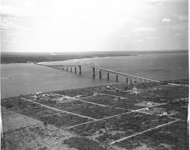
Aerial photos of Jamestown, especially over the North Island show a massive amount of forest canopy, over 1,400 acres. The worst time to deal with a forest fire is during dry weather conditions where water resources are in short supply. In addition, our small island Fire Department doesn’t appear to have enough resources, equipment and man power, to fight one. A managed forest, especially those surrounding homes, can lessen the chances of fires starting and spreading out of control while assisting with access for fire fighters.
We have been lucky to not have conditions that set off wildfires like
they have had in California and Australia recently but, should
global warming continue, it's just a matter of time before our forests
become a tinderbox for disaster.
The water use of mature trees
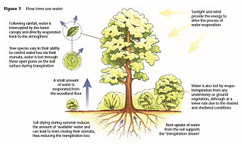
The water saving benefits of forest management require a bit of background to appreciate, so to start with, lets go to the root of the issue, so to speak. Rather than focusing on the uninhabited forests we'll start with the impact of water on developed land using a patch of lawn that will be replaced by a typical swamp maple tree which are most common on the Island.
The tree eventually, for our analysis, will have a trunk that is 16” in diameter. So the amount of replaced lawn will be about 200 square inches where the circumference of the tree trunk will eventually occupy. Since an inch of lawn has roughly 47 blades of grass per square inch, the area of a mature maple tree at 70 years old with a 16" diameter at breast height would replace 9,445 blades of grass.
A mature maple tree can have between 200,000 to 500,000 leaves that have more than 10 times the surface area of a blade of grass. (5 inch blade of grass 3/8" wide has 4 square inches of surface area. A 5 inch maple leaf has @ 40 square inches of surface area for transpiration) Total transpiration (aka. evaporation) area of the 16" inches of grass replaced by the tree is 37,780 square inches while the tree's canopy of leaves has a leaf surface area between 8,000,000 to 20,000,000 square inches of transpiration.
So applying math to compare the transpiration requirements of a mature tree compared to the blades of grass it replaces, its obvious that we would lose a whole lot more water. There are several resources that estimate how much water a mature tree uses, one by the USGS titled Evapotranspiration and the Water Cycle, sets the number at around 100 gallons per day. In the Jamestown Shores, a home with one mature tree would be taking/keeping from the aquifer, three times as much water per day than they would use without it. Those homes with several mature trees on their property would be wise to remove a few knowing it would improve the recharge capacity of their wells.
Now let’s go over to the vacant lot across the street and see how much water it needs to support the trees growing there.
A 2012 report by United States Department of Agriculture on the Forest Resources of Connecticut, Massachusetts, and Rhode Island provides a significant amount of data about rural forest composition. They concluded that an average acre of New England forest contains 202 live adult trees 5 inches and larger in diameter at breast height, 4,602 seedlings and saplings, and 12 standing-dead trees, or 4,816 trees per acre.
An article by Steve Nix, a member of the Society of American Foresters, tells us how Trees Absorb and Evaporate Water via Roots and Leaves explains how trees gain biomass from the water they use, explaining that a single acre of forest land, during the course of a growing season, can add 4 tons of biomass but uses 4,000 tons of water to do so. That computes out to 960,000 gallons per acre, over roughly nine months, or 3,555 gallons of water per day.
When we review the daily use of the North Island at full buildout being just 42,760 gallons per day we can see that it is the amount used up by just 12 acres of forest. The water use for the South Islands, which is mostly from reservoirs through water shed runoff, is at 197,760 gallons per day at full buildout but... just 50,000 gallons per day would come from the bedrock aquifer during the summer months of high demand. That use is equal to the daily forest withdrawal from just 14 acres of forest.
If we implemented a forest management plan that would remove enough trees to replenish all the current daily water used in the Shores through thinning, the visual impact would hardly be noticeable.
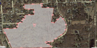
An aerial view of the forests that are spread throughout the Shores neighborhood from Capstan Street to Rt 138 to the South has a total of 135 acres. (See photos) Using the computation of a mature tree with 16 inches of breast height diameter requiring 100 gallons of water per day or 6.25 gallons per inch of trunk width, of the 202 adult trees with a 5 inch or more of diameter, we would only need to remove 3 that are just 13+ inches in diameter to meet the total diameter requirement of 41 inches per acre of the 135 acres of forest resource. ( 41 inches x 135 acres x 6.25 gallons of water per inch = 34,593 gallons per day)
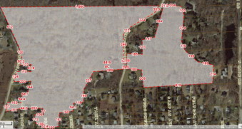
When we look at the Water Department’s forest surrounding their deep water aquifer wells, the thinning would need to be a bit more, but still would leave a robust tree stand. That area south of the North pond is approximately 42 acres of forest with wells that draw 50,000 gallons per day during the peak summer months of use. Using the 6.25 gallons per inch of tree trunk requirement mentioned above, we would need to remove 15 trees of 12 inch diameter from the estimated 202 adult trees per acre. That effort would still leave a healthy forest canopy with room for smaller trees to grow full and strong.
In addition to the Deep water wells to the south of North Pond, there are approximately 100 acres of forests that surround the reservoir that provide the runoff water supply from rain events. Forest management can also assist with supply by reducing the total canopy interception and improving runoff volume. A 2016 study by American Society of Agricultural and Biological Engineers that calculated 10 years of data about canopy interception concluded the average amount of water captured by a full grown tree was 19% of the rain that otherwise would have been part of the total runoff supply.
The significance of their study is that it confirms many other short term studies done earlier, to support increased urban plantings of trees. The largest of trees can capture up to 1 inch of rain that evaporates and never reaches the ground which is significant to communities that rely on rainwater for supply.
Jamestown, one of the few officially identified
as a Sole Source Aquifer, has averaged 38 inches of rainfall per year, over the
past 10 years, which is not considered to be high. A loss
of any percent is a significant one, let alone 19%.
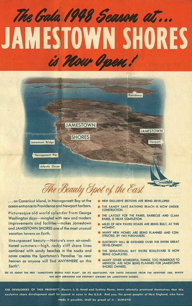
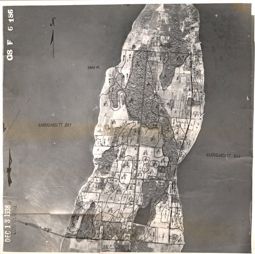
The canopy density of our North Island forests is extremely thick because they have been left to expand without intervention. The growth is also impressive when you think that at one time, not too long ago, the land was mostly grazing fields and brush. (see historic photos below)
It's time we face up to the responsibility of management for the forests that can provide a larger water supply and reduce the potential of property loss through fires.
Other Aquifer Recharge Options...
In addition to
Forest Management to assist on aquifer recharge there are other projects
that appear to be more costly and complex but... here they are for
consideration.
1) Transfer from Treatment Facility. Unlike the homes
on the North Island that have there own septic systems that return most
of their water use back to the Aquifer, the Town’s water use through the
Water Department is never returned to the North Island
for recharge.
It ends up in the bay (a bit to the golf
course during the summer) after going through the Wastewater Treatment
Facility and that includes an additional amount of water that
infiltrates into the sewer lines from the surrounding groundwater where
cracks and separations of older pipes exist which, at times, is more
than the plant is licensed/permited to handle.
In December 2019, the data from the Water and Sewer Departments shows an
average of 145,000 gallons of water delivered to the Southern Island
customers per day and even though all users are not attached to the
sewer lines, the Wasterwater treatment plant averaged 835,000 a day of
inflow.
So what if all that treated, used water was sent to recharge the Town’s
aquifer instead of sending it out into the bay? The idea is not unusual
and has become more common throughout the country as being the best way to
manage the resource. Even if all the old pipe infiltration was
eventually fixed, the impact of returning to the aquifer just what was
used everyday by the Southern Islands users would be significant.
The project would involve a single pipeline be installed to divert the
treated water that is going into the bay... back to the watershed/land
area around the North Pond which is just 2 miles up the road. Once there,
it would be distributed/infused around the watershed to recharge the
aquifer.
Unfortunately, there is a construction cost involved that would become a
burden to the users and it's reasonable to assume that there's a
priority to fix the old pipes that are causing the infiltration that
puts an unnecessary burden to the Wastewater Treatment department’s
budget. The Water and Sewer customers, struggling with ever increasing
rates, have been adopting conservation measures to reduce their
bills which has put even more strain on the department with lower
revenues.
2) Recharge from road runoff. Although it is a bit
early to view the results of the North Road recharge project, this
method has enough promise that the State has invested into the method
with grant money.
The process captures and redirects roadway runoff water, that would
normally end up in the bay, into watershed land to assist in recharge
of the aquifers. With North Pond, it is being directed into wetlands
that are adjacent to the reservoir in order to filter out contaminants
and add new supply to the surface runoff accumulation.
This method has lots
of potential throughout the Shores as well, where there are conservation
lots along several roadways that would allow for the runoff to be
redirected onto them and having it infiltrate into the bedrock aquifer
through the natural process.
Fortunately much of the Shores terrain is hilly, allowing for good
drainage flow, which is evident when looking at the wetlands and
conservation property in the lower areas that are closer to the
shoreline. Many of the Town’s protected lots are in perfect locations to
take advantage of the street water runoff for this type of recharge. It
would require a small effort by the DPW to cut out redirection gutters,
along with a little excavating to spread out the recharge.
When we consider that one inch of rain, on an acre of land, will
accumulate 28,000 gallons of water and, throughout the entire Shores
that amount is more than half of everyone's net daily use not returned
to the aquifer, it would not take many street water redirections into
conservation lots, to provide additional peace of mind about supply.
3) Route-138 runoff. Not unlike the two previous
methods, this option was being considered a possibility by the former Town
Administrator, Andy Nota. On the North Island, where the state highway
exits at Helm Street, there is a major runoff collection system that can
accumulate up to a million gallons of water from Route-138 rain events.
The supply is currently being released into the bay but could be
redirected/better used for groundwater recharge.
There is a large amount of engineering review needed to bring this to a
viable solution, and depending on the watershed it would recharge,
construction costs would add a financial burden to the benefactors but
it is worth looking into as an option.
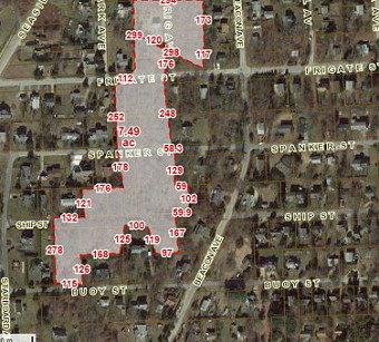
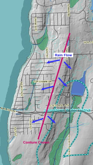
Shores Contour View with Rain Flow Direction


Click Here for the above study